Bear Creek Road (The Three Bears)
Description
The Three Bears are the three climbs on Bear Creek Road, one of the most popular routes in the area (featured prominently in the Grizzly Peak Century). Not much traffic, not much civilization (bring water). The intermediate and advanced rides are especially notable, the latter tacking on the ridiculous El Toyonal/Lomas Cantadas climb.
The rides start at Orinda BART, and end variously at Walnut Creek, Orinda, or Rockridge BART. It’s more traditional to loop clockwise around San Pablo Reservoir; this route approaches from the other direction, which makes it longer and a little bit quieter, with more ups and downs. Or, take the gravel option, which goes clockwise but skips most of busy San Pablo Dam Road by hitting some gravel on lovely Old San Pablo Dam Road.
Route Maps
Beginner’s (15km)
Start: Orinda, End: Walnut Creek
Intermediate (46km)
Start: Orinda, End: Orinda
Advanced (56km)
Start: Orinda, End: Oakland/Berkeley (Rockridge)
Gravel option (39km)
Start: Orinda, End: Orinda


Road Notes
St. Stephen’s bike path (all rides)
To get on the bike path, you have to go through gyrations: take Moraga Way southbound (you have to loop around the station a bit, follow the signs), then get over to the left to turn left at the first light, into downtown Orinda. Take your first left past the Orinda movie house, then turn right on Bryant Way, right on Davis Road, and onto the sidewalk/path just before Bates Blvd. The St. Stephen’s bike path is uninspiring but useful; it parallels Highway 24 between Orinda and St. Stephen’s Road, which turns out to be the most direct and least hilly way between Orinda and Lafayette. The path is separated from the highway, and doesn’t get much foot traffic, so it’s reasonably pleasant. It climbs gradually for most of its length.
El Nido Ranch Road (all rides)
El Nido Ranch Road is a wide residential road with little traffic. It descends gradually to the Lafayette city limits, and then there’s a fast downhill curve leading up to a terribly-placed stop sign just before the freeway entrance. Blow through the sign, and prepare to turn left on Upper Happy Valley Road, the next stop sign.
Upper Happy Valley Road/Happy Valley Road (all rides)
Upper Happy Valley Road is wooded and residential and has little traffic. It climbs gently for a while and then has a short, steeper section (but it’s not too bad). It ends at Happy Valley Road, which is also wooded and residential, but is wider and has slightly more traffic. It has a reasonably nice descent, but the pavement isn’t that great. It descends all the way to the BART station. Turn left on Deer Hill Road just before the BART parking lot. (Or bail out at BART).
Deer Hill Road (all rides)
Deer Hill is a wide road with moderate traffic. It has a couple of short climbs and short descents, then a short, steep climb and a short, steep descent to a stop light at Pleasant Hill Road.
Stanley/Mount Diablo/Oakland (beginner’s ride)
Deer Hill changes names to Stanley Boulevard; it gradually climbs through a residential area with little traffic, then gradually descends to Mount Diablo Boulevard. Turn left on Mount Diablo (the intersection is tricky; you have to turn left twice, basically), go under the freeway and turn left on Oakland. Oakland is a low-traffic commercial street that will take you all the way to the Walnut Creek BART station.
Pleasant Hill Road/Reliez Valley (intermediate/advanced ride)
Pleasant Hill is a busy, wide connector to Reliez Valley, which is wooded and narrower with less traffic. It used to be rural but now increasingly has McMansions and related cars. There’s a relatively short, steep climb followed by a fast, fun descent, where it enters into more rural territory.
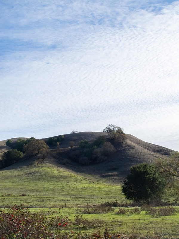
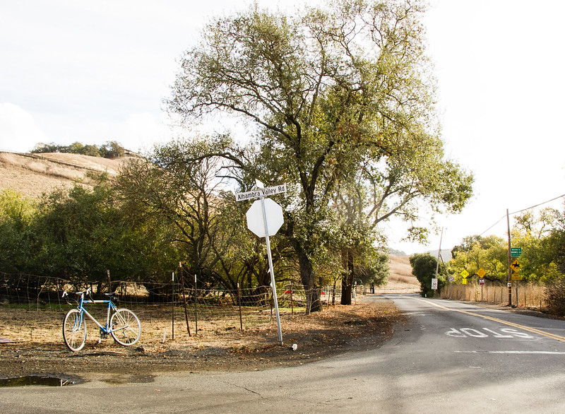
Alhambra Valley (intermediate/advanced ride)
Reliez Valley becomes Alhambra Valley (go straight, not right), and traffic levels drop to near zero after the intersection. It starts with hills rolling gradually upwards, which tend to sap your strength if you attack them too aggressively early. After emerging from the wooded area there’s a serious climb (Pig Farm Hill) followed by a fast, long descent which ends at Bear Creek Road.
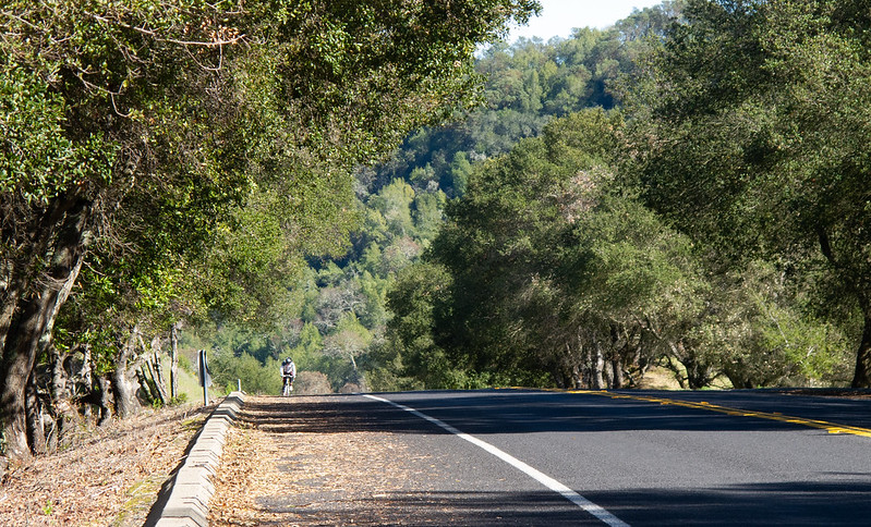
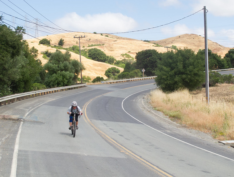
Bear Creek Road (intermediate/advanced ride)
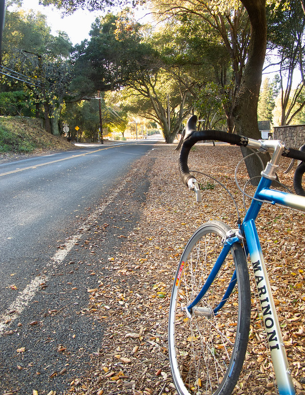
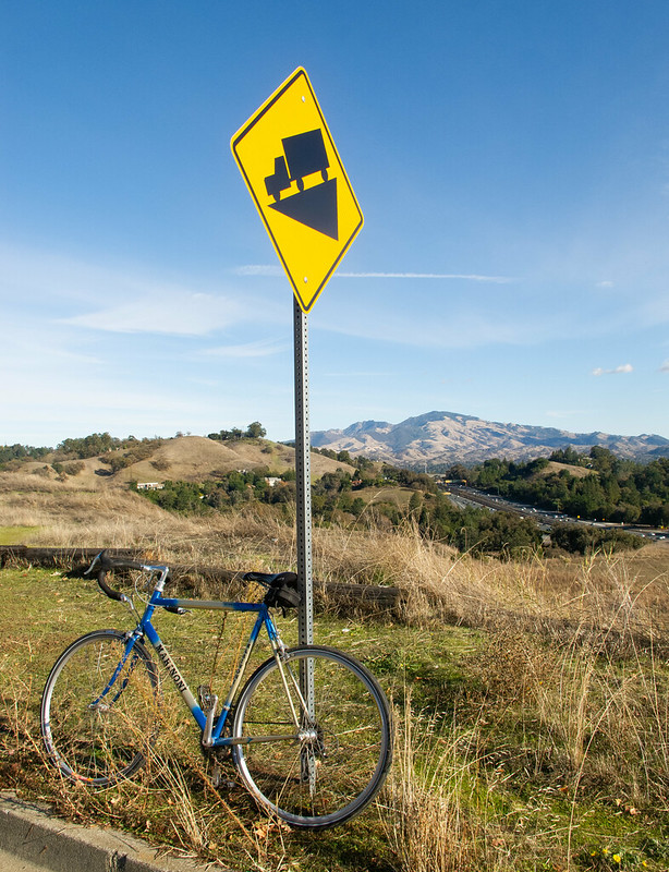
Bear Creek is one of my favorite roads; wide and pretty with steady climbs and lively descents. It has two significant climbs, Mama Bear and Papa Bear. Both are straight and even at about 7%; get in a low gear and grind up them. They are also unshaded, so be wary of overheating, and pull over and take a drink if you get hot. After Mama Bear there’s some rolling on the top and then a nice fast descent to the bottom of Papa Bear. Papa Bear lasts just over 1 km, then there’s an awesome fast descent–the only thing to watch out for is the gravel on the shoulders. The road flattens out, then ends with a short climb (Baby Bear, which by this point is often not “just right”).
El Toyonal/Lomas Cantadas (advanced ride)
El Tonoyal is a pretty rough climb, about as steep and long as the hard part of Centennial. But then the hard part starts. You can continue on El Tonoyal and go over a partially washed-out bridge and hook up with Wildcat Canyon, but this route turns left and goes up Lomas Cantadas, which is the hardest climb to Grizzly Peak from the east. The straight climb towards the stables is the hardest part; once you make the right turn past the stables towards the llama pen, you have pretty much made it.
Grizzly Peak/Claremont (advanced ride)
The rest of the ride is a fun, twisty descent through Claremont Canyon. There’s usually some traffic on these roads, but you’ll probably outpace it. There are two steep hairpins on Claremont that you should be careful about.
Old San Pablo Dam Road (gravel option)
Head into the EBMUD staging area for Briones Reservoir to take Old San Pablo Dam Road. Almost no traffic, a lovely ride through oak woodlands, reconnecting to San Pablo Dam Road later after some abandoned roadway with broken pavement and gravel sections. Generally fine for road bikes, but not passable if the ground is wet.
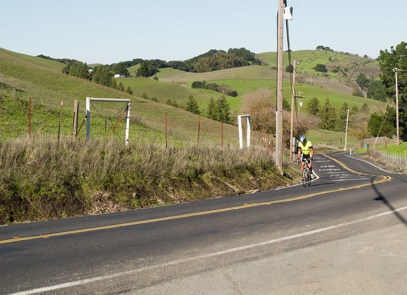
Castro Ranch Road/Alhambra Valley Road (gravel option)
Approaching Bear Creek in the clockwise direction, you get a climb with moderate traffic (and usually a lot of glass in the bike lane) on Castro Ranch Road, then a fast descent to Alhambra Valley Road. Try to keep your momentum as the turn onto Alhambra Valley swoops right at the bottom of the hill. Alhambra Valley in this direction is a pleasant, rolling road through pastureland.